-
 Continue reading →: Memoirs: Adventurous in Nature | Book List (2026 & Evergreen)
I LOVE lists, so here are some of my favorite adventure memoirs I’ve read in the past decade or so. This 15-book list is not in any particular order of preference, and certainly not exhaustive; I was aiming for variety. Add your favorites in the comments below! Appalachian Trail 1.…
-
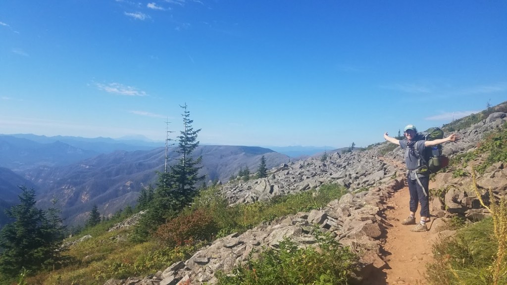
 Continue reading →: Backpacking the Pacific Crest Trail Oregon – Day 40 to Cascade Locks and the Finish Line
Backpacking the Pacific Crest Trail in 2020, today’s leg brings me to the finish line at Cascade Locks.
-
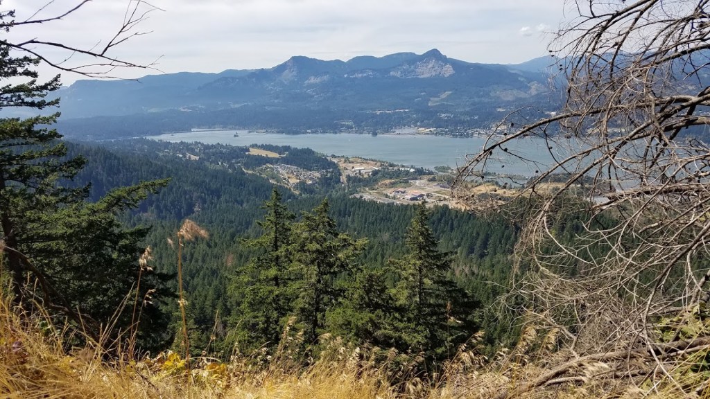
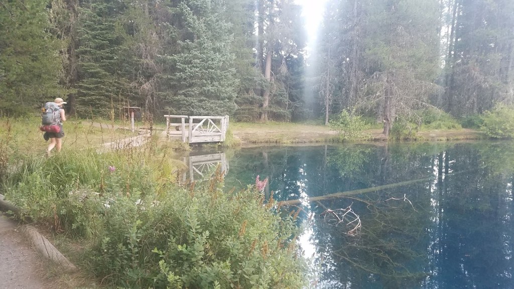
 Continue reading →: Backpacking the PCT Oregon – Day 39 to Wahtum Lake
Backpacking the Oregon section of the PCT in 2020, Day 39 lands me at Wahtum Lake, nearly at the end of my journey.
-
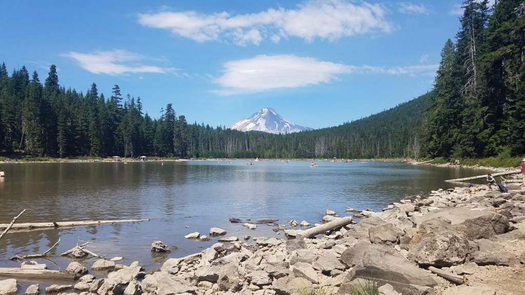
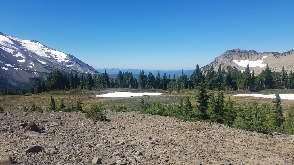
 Continue reading →: PCT Oregon – Day 38 to Lolo Pass
In the summer of 2020, I backpacked the entire Oregon section of the Pacific Crest Trail. Here is Day 38 – the epic day of hiking from Timberline Lodge to Lolo Pass. Crossing three rivers, wildflower packed meadows, and hiking in the dark.
-
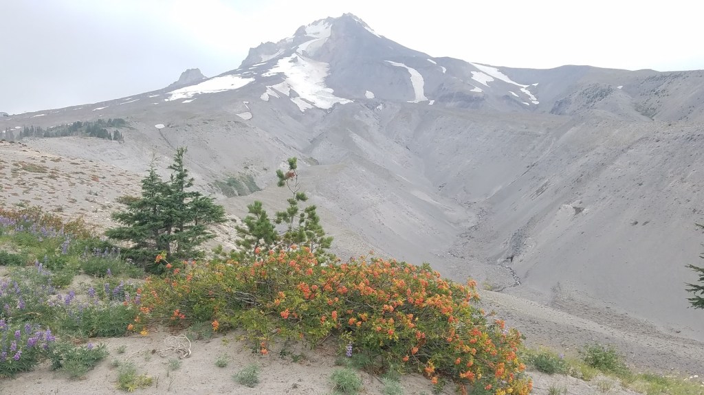 Continue reading →: Backpacking the PCT Oregon – Day 37 to Timberline Lodge
Backpacking through the state of Oregon on the Pacific Crest Trail, summer 2020 – this day lands me on top of Mt. Hood at Timberline Lodge to enjoy a bed, shower, beer, and fresh food.
-
 Continue reading →: PCT Backpacking – Day 36 to Frog Lake at Wapinitia Pass
Backpacking Oregon’s section of the Pacific Crest Trail summer 2020. This leg takes me from Little Crater Lake Campground to Frog Lake at Wapinitia Pass.
-
 Continue reading →: Pacific Crest Trail Oregon – Day 35 to Little Crater Lake
Backpacking the Oregon section of the Pacific Crest Trail, summer 2020 – nearing the end of the state, I pass Timothy Lake to camp at Little Crater Lake campground.
-
 Continue reading →: Backpacking Oregon’s Pacific Crest Trail – Day 34 to Warm Springs Camp
In 2020, I backpacked my way through the entire state of Oregon on the PCT. This leg takes me from Lemiti Meadows to Warm Springs Camp – getting close to Timothy Lake.
-
 Continue reading →: Backpacking the PCT Oregon – Day 33 to Lemiti Meadows Camp
Backpacking the Oregon section of the Pacific Crest Trail in 2020 – day 33 describes the lovely trek to Lemiti Meadows Camp
-
 Continue reading →: PCT Oregon – Day 32 to Olallie Lake
I went on a grand adventure Backpacking the Oregon section of the Pacific Crest Trail last summer, 2020. Here are the chronicles from Day 32.
Hello,
I’m Heather
Welcome to my site where I share adventure stories, trail reports, and environmental insights. I’m a Pacific Northwest native, lived nearly my whole life in Oregon, and am currently residing in Portland, OR. With a background in marketing, event planning, and environmental conservation and a passion for all things outdoors, I enjoy writing about adventures. Take a deep dive into the Oregon Section of the Pacific Crest Trail with my daily trail reports from 2020. I love growing my circle – so connect with me on LinkedIn or Instagram!
Let’s connect
Join the fun!
Stay updated with my latest adventure reporting by joining the newsletter.
