-
 Continue reading →: Hiking the PCT Oregon – Day 31 to Jefferson Park
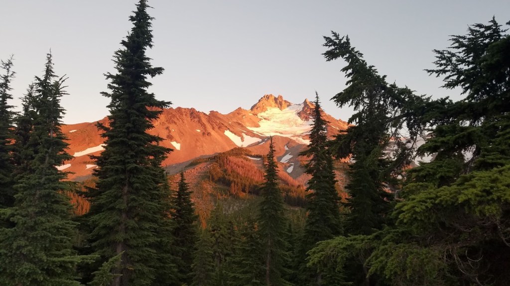
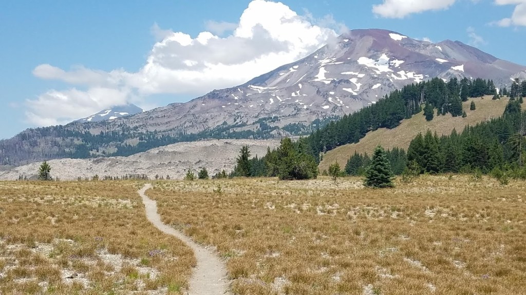
Day 31Today’s Miles: 12 Total Miles: 342.6Hanks Lake to Jefferson Park It’s with a heavy heart I write about this amazing day, knowing the area doesn’t look anything like my pictures after the fire swept through late summer, 2020. The beautiful landscape will rejuvenate of course, but I’ll be forever…
-
 Continue reading →: Backpacking the Pacific Crest Trail Oregon – Day 30 to Hanks Lake
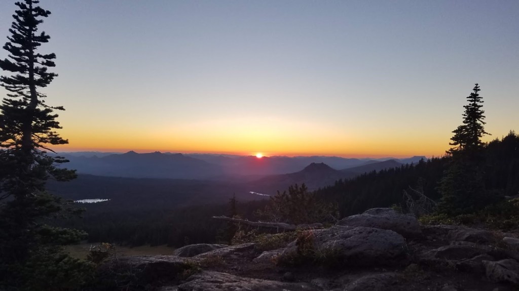
Today is my last day solo backpacking through Oregon. I hike along Three Fingered Jack, passing Minto Pass, Rockpile Lake, and a lot of burnt trees to my final destination – Hanks Lake to meet my hiking buddy!
-
 Continue reading →: Pacific Crest Trail Oregon – Day 29 to Three Fingered Jack
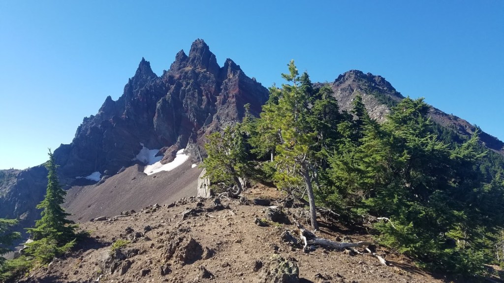
Backpacking the Oregon Pacific Crest Trail – Summer 2020. Day 29 takes me from Lava Camp Lake Campground to the base of Three Fingered Jack on my biggest mileage day yet – nearly 25 miles and traversing TWO mountains!
-
 Continue reading →: PCT Oregon Day 28 – Zero Day on the McKenzie Pass
Hiking the Oregon section of the Pacific Crest Trail in 2020, this zero day on the McKenzie Pass provides rest and time with my family exploring the area.
-
 Continue reading →: PCT Oregon – Day 27 to Lava Camp Lake Campground
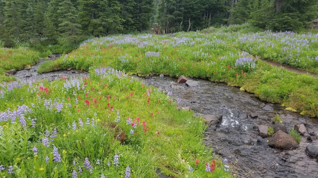
Traveling through the state of Oregon on the Pacific Crest Trail, this day takes me from Reese Lake to Lava Camp Lake Campground through the mist and fog, wildflower meadows, and near big mountains.
-
 Continue reading →: Backpacking the PCT – Day 26 to Reese Lake
Hiking the Oregon section of the Pacific Crest Trail, I am wowed by all the Central Oregon beauty of majestic mountains and brilliant wildflowers during this leg leaving Elk Lake northbound. #PCT #Oregon #backpacking #Pacificcresttrail
-
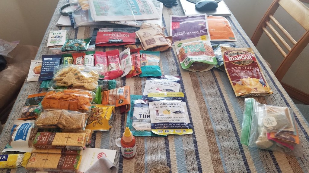 Continue reading →: Hiking the PCT Day 22-25 – Zero Days in Bend
Backpacking from the Oregon/California border to Washington – this is Day 22 enjoying time off in Bend.
-
 Continue reading →: Pacific Crest Trail Oregon – Day 21 to Elk Lake
Backpacking the Oregon section of the Pacific Crest Trail in 2020 – this is Day 21 which takes me from Brahma Lake to Elk Lake. I’m in Central Oregon.
-
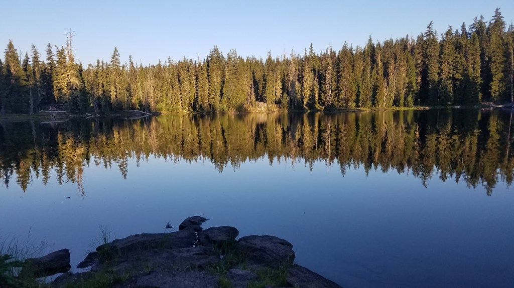
 Continue reading →: Hiking the PCT – Day 20 to Brahma Lake
Hiking the Oregon section of the Pacific Trail NOBO in 2020 – Day 20 takes me from one beautiful lake to another – Bobby to Brahama. I’m nearly to Elk Lake now.
-
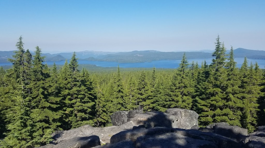
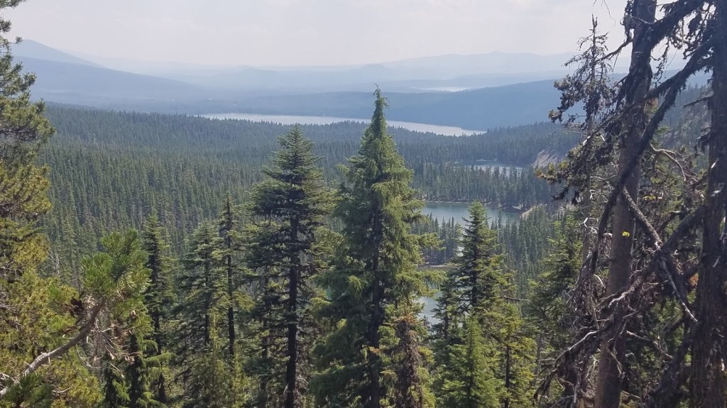 Continue reading →: PCT Oregon – Day 19 to Bobby Lake
Hiking the Oregon section of the Pacific Crest Trail in 2020 – Day 19 to Bobby Lake (near Odell Lake).
Hello,
I’m Heather
Welcome to my site where I share adventure stories, trail reports, and environmental insights. I’m a Pacific Northwest native, lived nearly my whole life in Oregon, and am currently residing in Portland, OR. With a background in marketing, event planning, and environmental conservation and a passion for all things outdoors, I enjoy writing about adventures. Take a deep dive into the Oregon Section of the Pacific Crest Trail with my daily trail reports from 2020. I love growing my circle – so connect with me on LinkedIn or Instagram!
Let’s connect
Join the fun!
Stay updated with my latest adventure reporting by joining the newsletter.