
Day 38
Today’s Miles: 17.6
Total Miles: 426.7
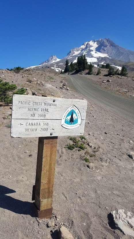
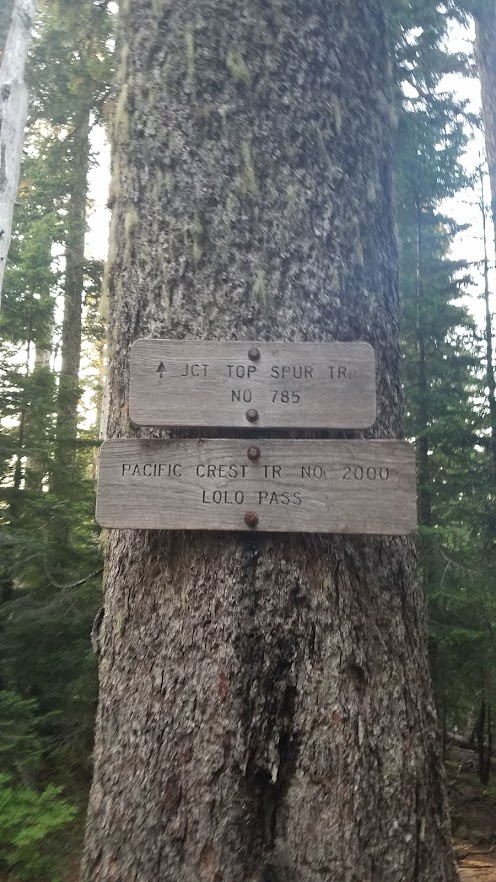
Timberline Lodge to Lolo Pass Trailhead
This was probably the most epic day of my entire Oregon PCT trek; full of big wow views, wonderful moments with Carl, a little bit of danger, and a REALLY long day. I’ve been anticipating this section from the planning phase for the three tricky water crossings, two “potentially dangerous” (according to my book). I purposefully planned to have someone do this leg with me because of them.

Thankfully, I was able to sleep in until 7 a.m. after my rough night of anxiety. We had a big hiking day ahead of us, so we were anxious to get on the trail, but equally wanted to enjoy the lodge for as long as possible since we paid for it. We enjoyed breakfast in the restaurant, and I took another shower, taking full advantage of amenities. Saying farewell to room 117, we hit the trail at 10 a.m.

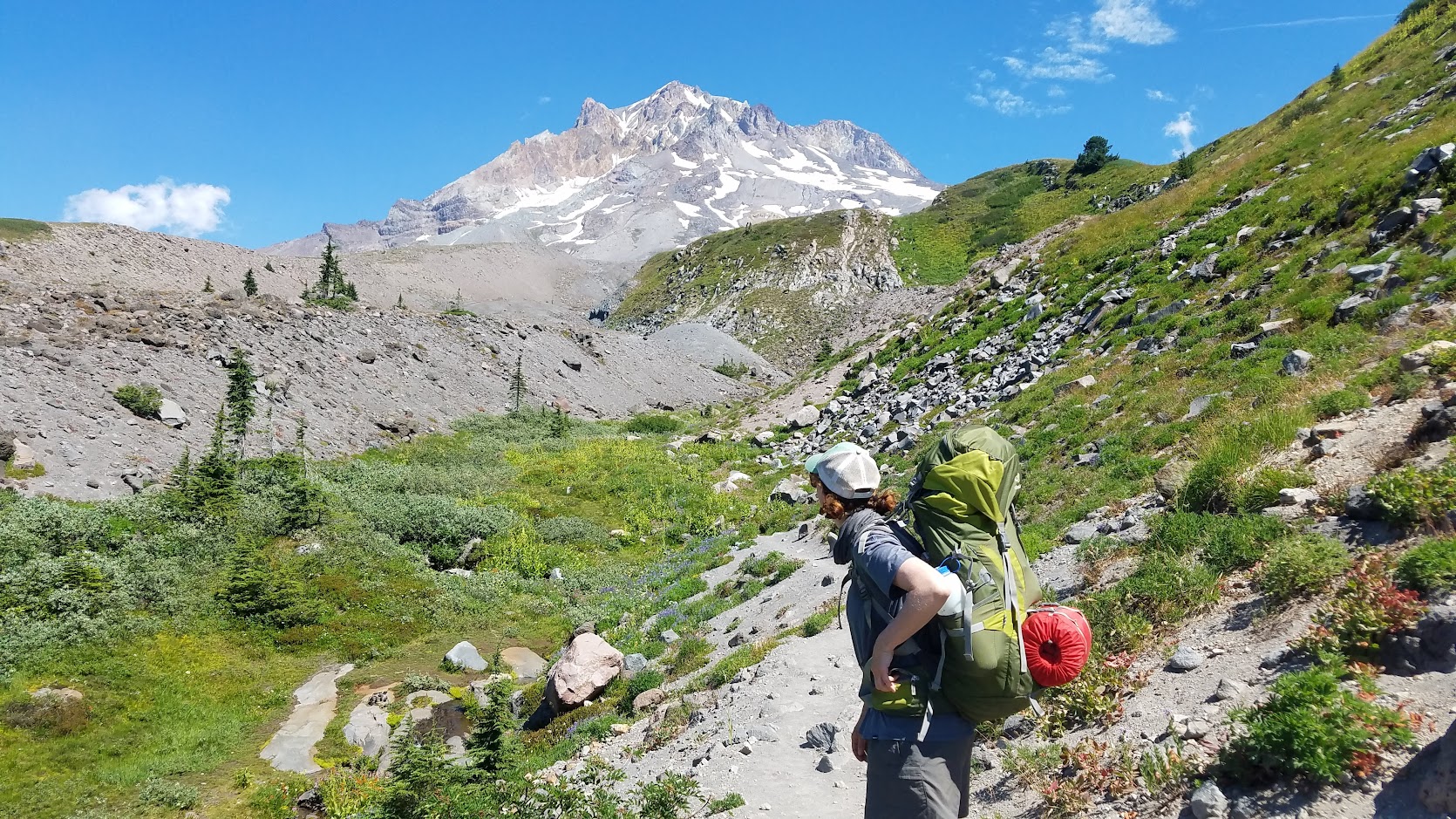
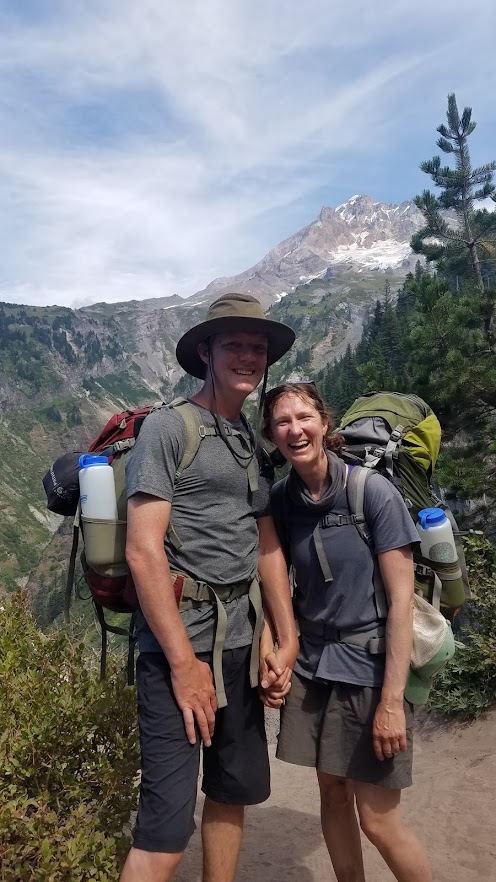
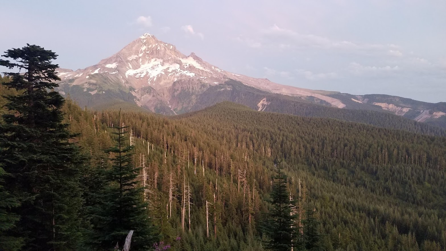
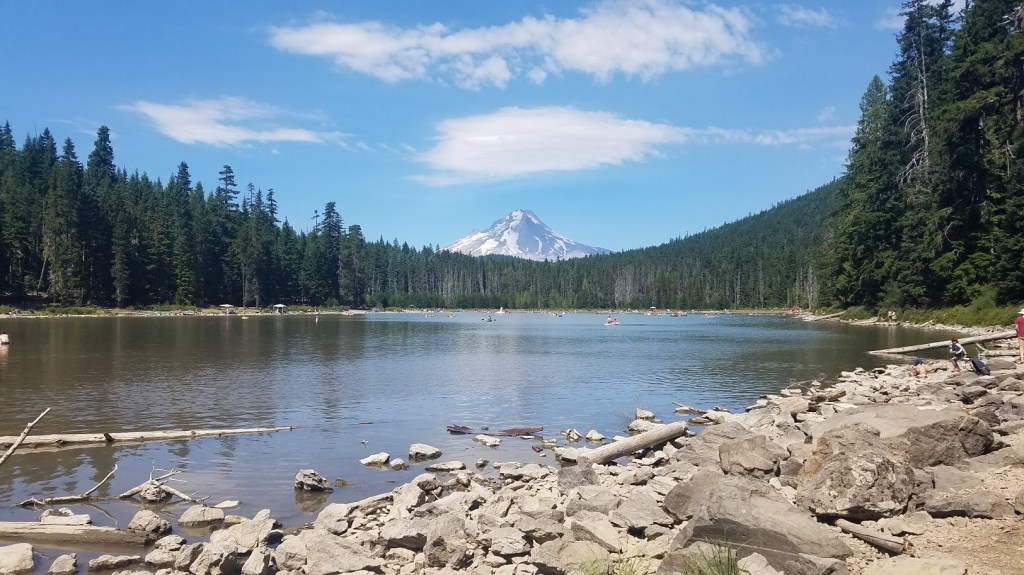
We have three days to travel 49.8 miles down to Cascade Locks, where my Oregon PCT hike would come to an end. Mt. Hood definitely gave Jefferson Park and the Three Sisters Wilderness competition for top PCT Oregon sections. It was simply incredible. We definitely want to come back and hike the entire Mt. Hood Loop Trail that circumferences the mountain.
This was another day of hiking with a goofy grin on my face, because I REALLY love mountains, and I was so happy Carl could enjoy such breathtaking scenery with me.
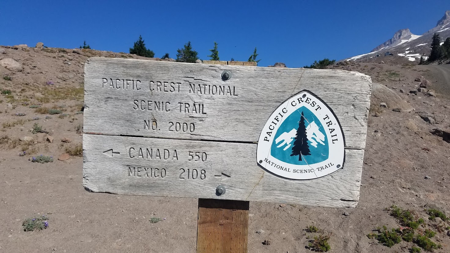
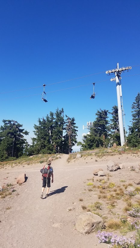
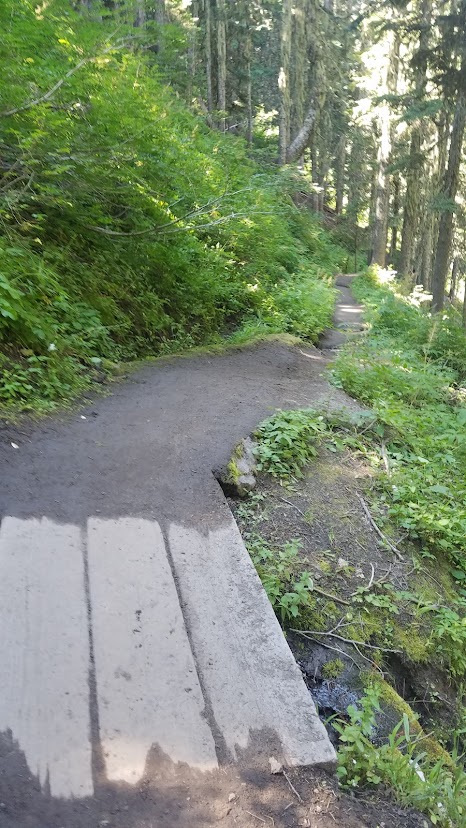
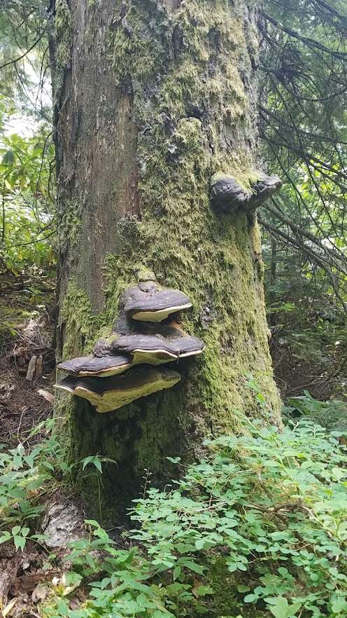
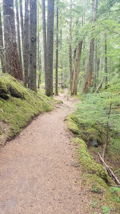
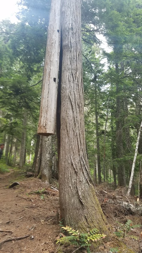
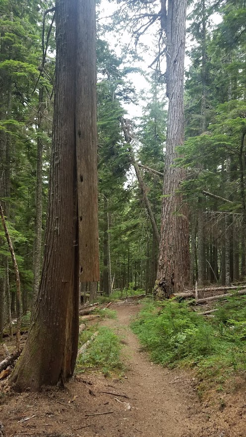
Photo warning ahead: I took a lot of pictures as we had a roller coaster day of ups and downs in elevation. Leaving the lodge, we hiked under the chairlift and across several little seasonal streams.
More people were on the trail near the lodge than I was used to, but we kept our masks at the ready if the trail became crowded. We didn’t see hardly anyone after a few miles in, making the day that much more magical.


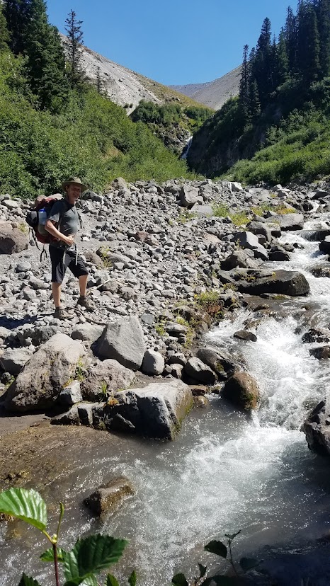
It didn’t take long to make our way down to the first of the two potentially dangerous water crossings – Zigzag River. There were a couple other hikers checking out route options. Since the water was low, it wasn’t a dangerous crossing at all, but I did want to keep my boots and feet dry if possible.
We watched one man trudge straight across at the trail, then watched a couple cross with just one leap between boulders up stream – followed with a thumbs up and a smile in our direction. We decided that was probably the easiest route.
After a quick water break we headed up stream. Of course, the water moved more swiftly in this section as it was forced into a smaller space, but it really was just a single leap across. Carl went first, dropped his pack, then came back over to grab my backpack for me. It was easy without my pack, but I would have been a tad nervous with it on. Just like that, the first potentially dangerous water crossing was over.
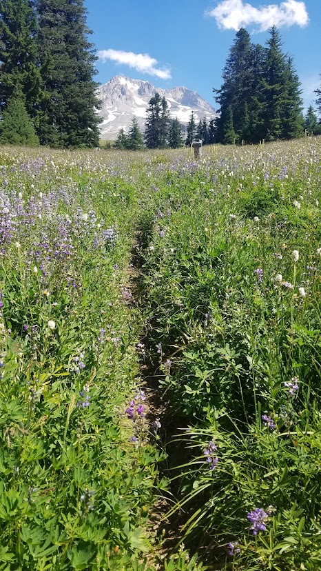
It wasn’t long before we got to the Paradise Park Loop Trail turnoff. The book highly recommended leaving the PCT, and hiking this parallel trail. For some reason, we opted to skip the first turnoff, thinking the second option was shorter.


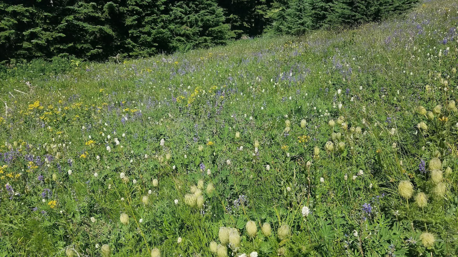
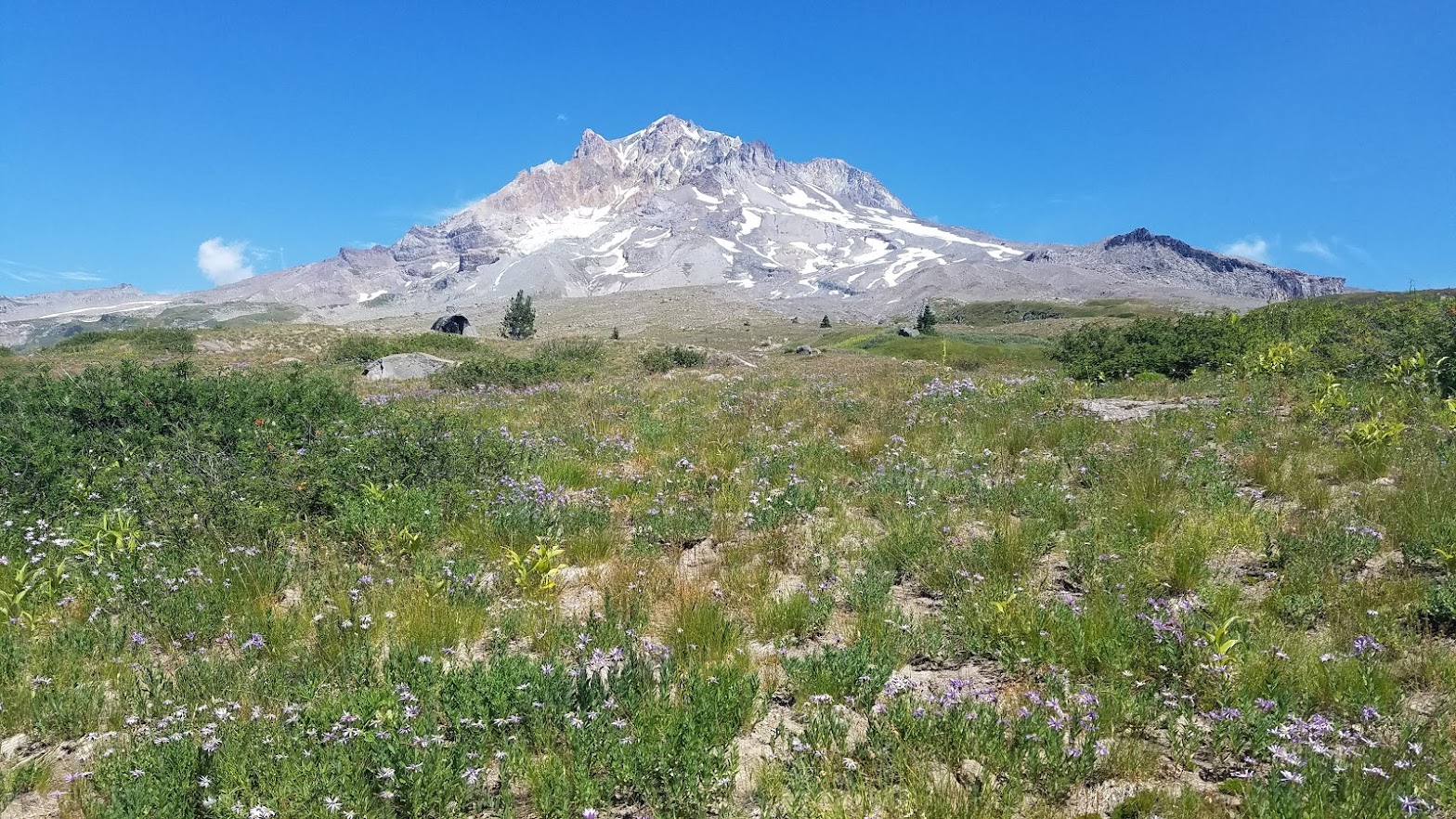
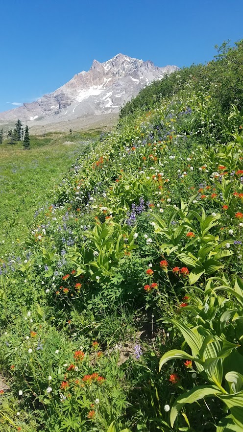
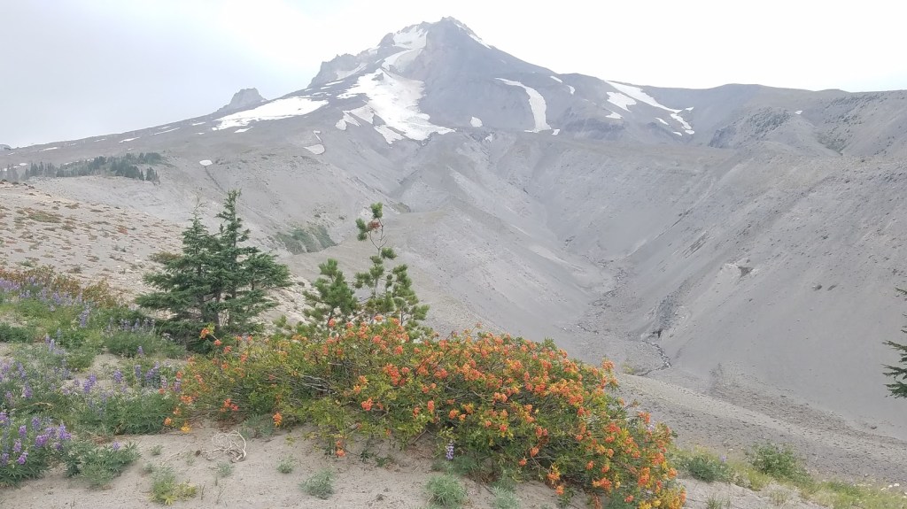
It might have been shorter, but it was STRAIGHT UP! Although it was a tough climb, we went through beautiful wildflower meadows, and when we finally arrived at the Paradise Loop trail, we were absolutely blown away, and kicking ourselves for not taking the first turnoff.
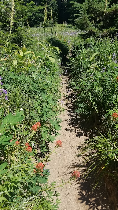
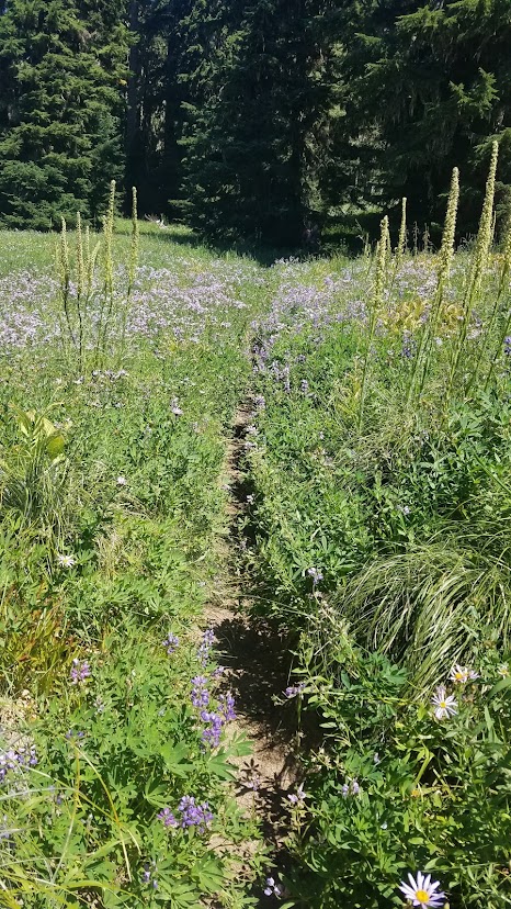

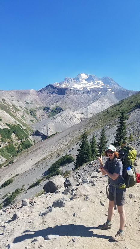
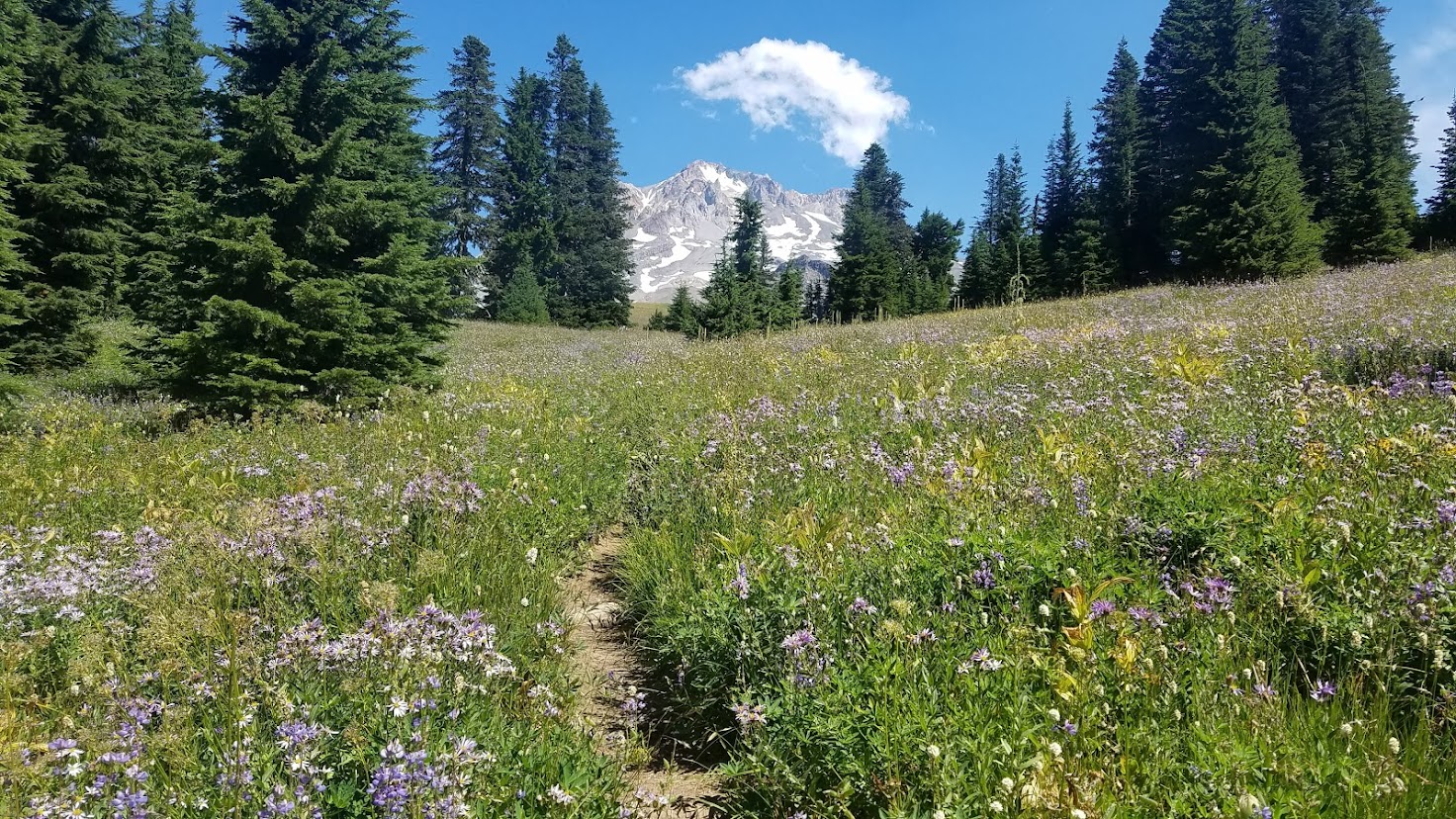
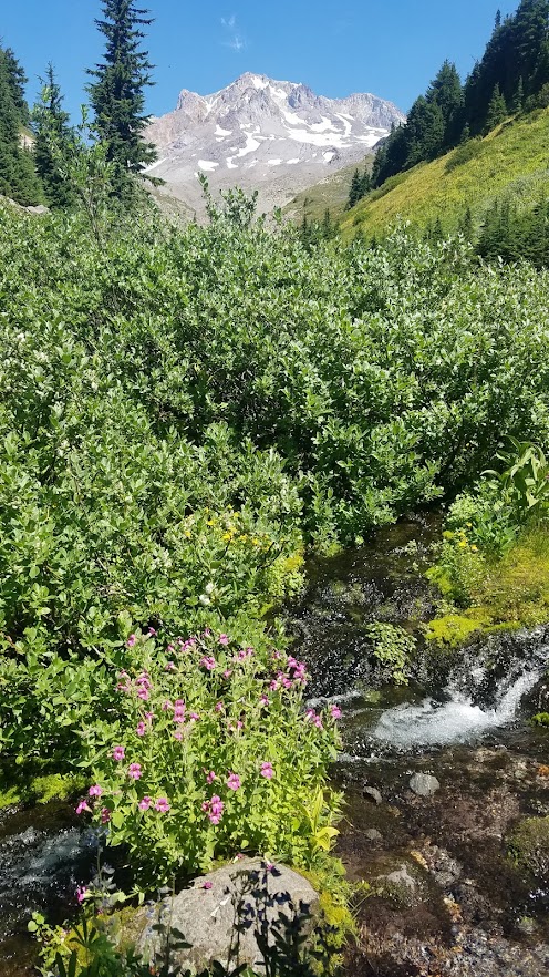
It was out of this world beautiful. Mt. Hood stood so majestic right in front of us, and HUGE. There were little creeks all over, and wildflowers galore. I could have spent an entire week in this area, it was breathtaking, and it took us a few hours to get through this section because we were in no hurry for it to end.
I took a million photos, and we kept wanting to take little breaks to soak it all in. One of the luckiest aspects of our day, was seeing only two or three other people the entire time we were on this trail (mid-week hiking)!
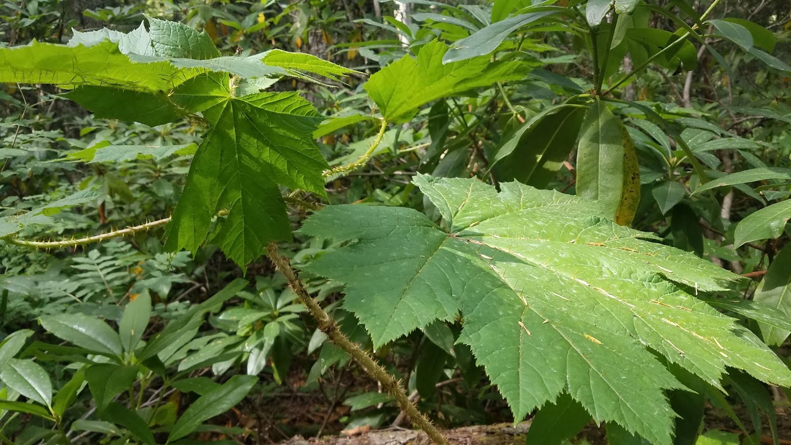
A highlight of not only this day, but my entire Oregon hike, was discovering the flower below. We called it the Dr. Seuss flower, and it lined the trail and filled the meadows. It’s so COOL!
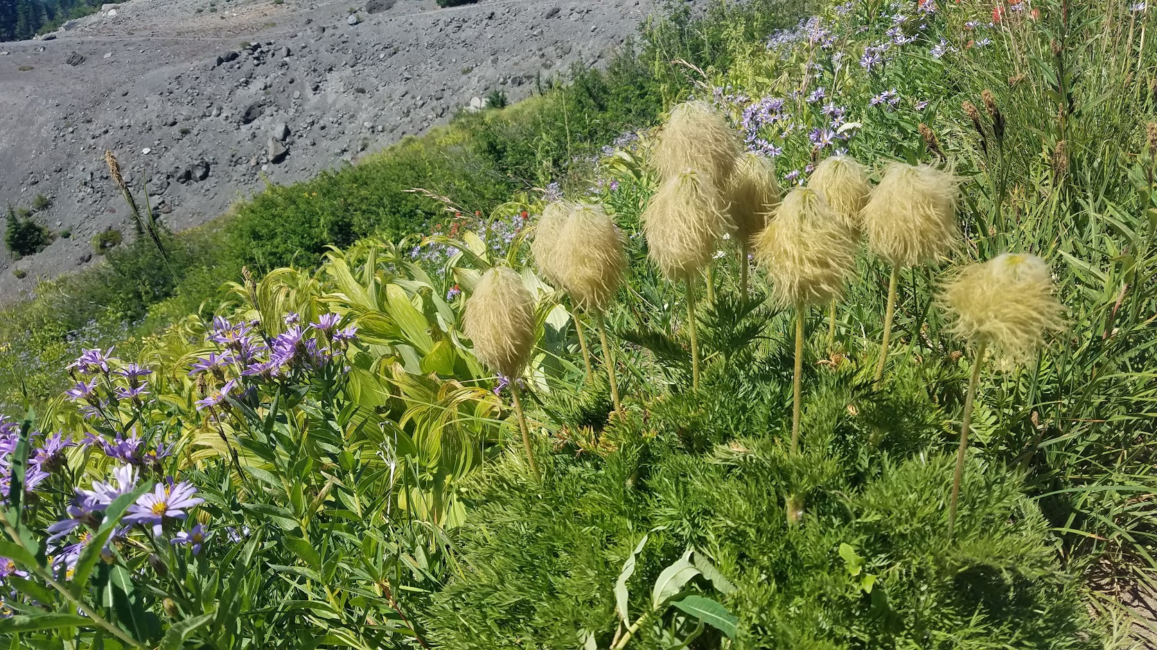
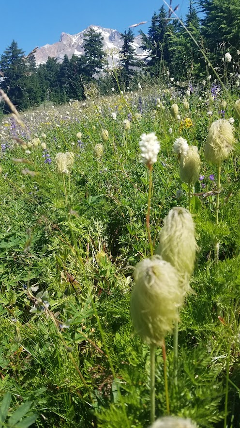

In my research after returning home, the flower is called Western Pasqueflower – a member of the Buttercup family, and this blog post explains more (with some additional fun photos).


One of our many snack breaks was an idyllic spot hidden in the cove of trees providing shade, a grand view of the mountain, and a gurgling creek below surrounded by flowers – so dreamy!

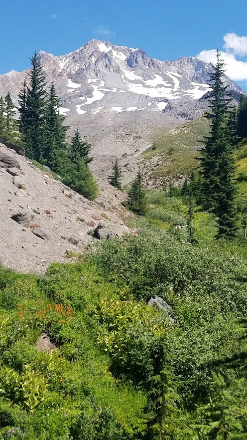
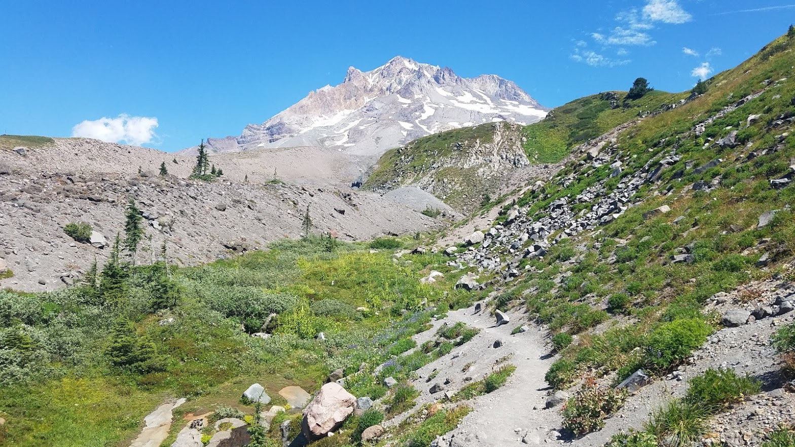
Shortly after, we came to wide open spaces with massive Mt. Hood to our right. That goofy grin never left my face. It was breathtaking.
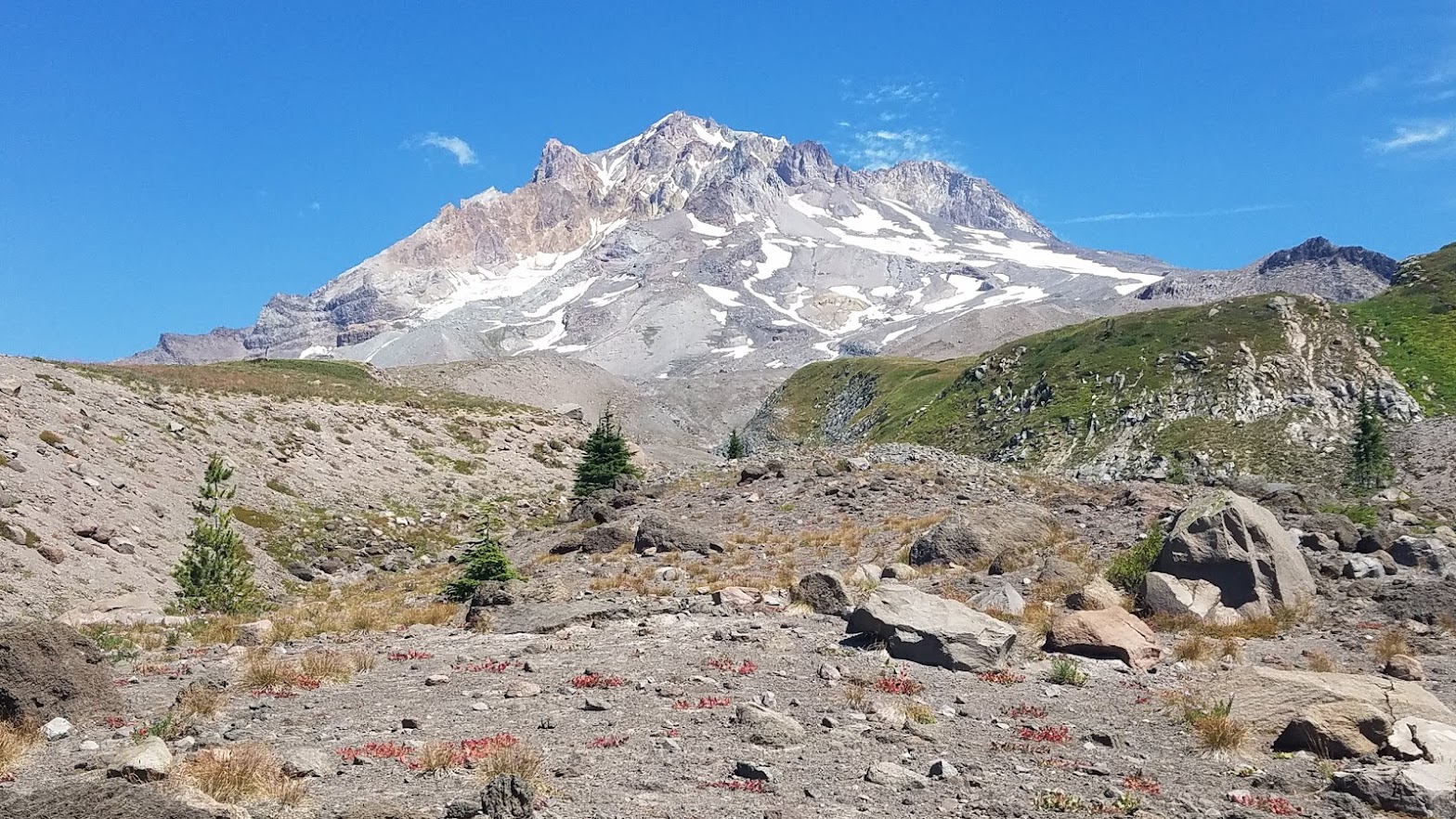


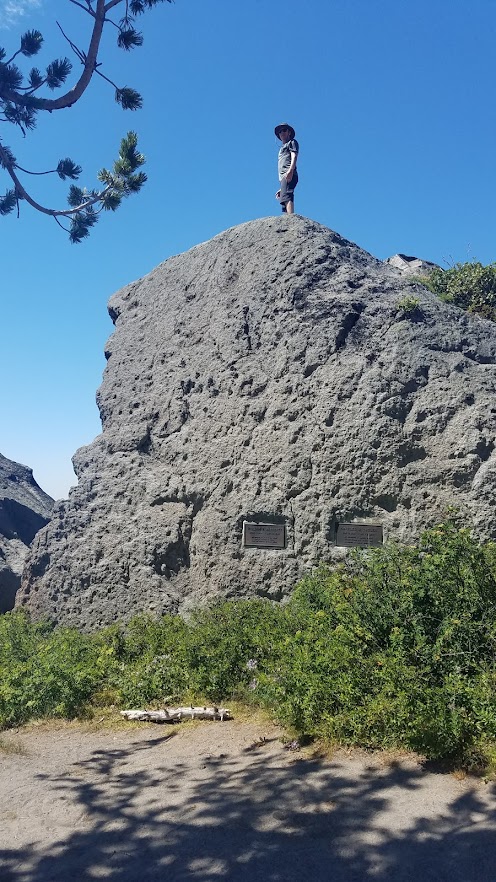
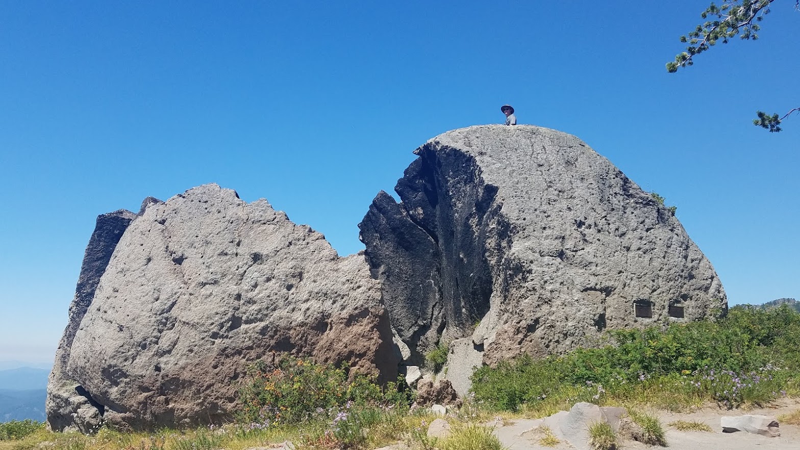
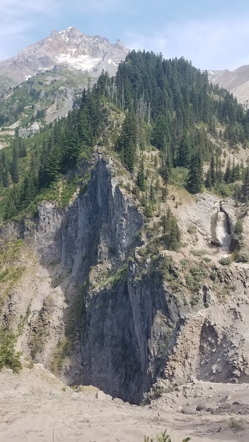
Spying a huge boulder not far off the main trail, several spur trails beckoned for us to go check it out. It looked like a scene out of an alien movie.


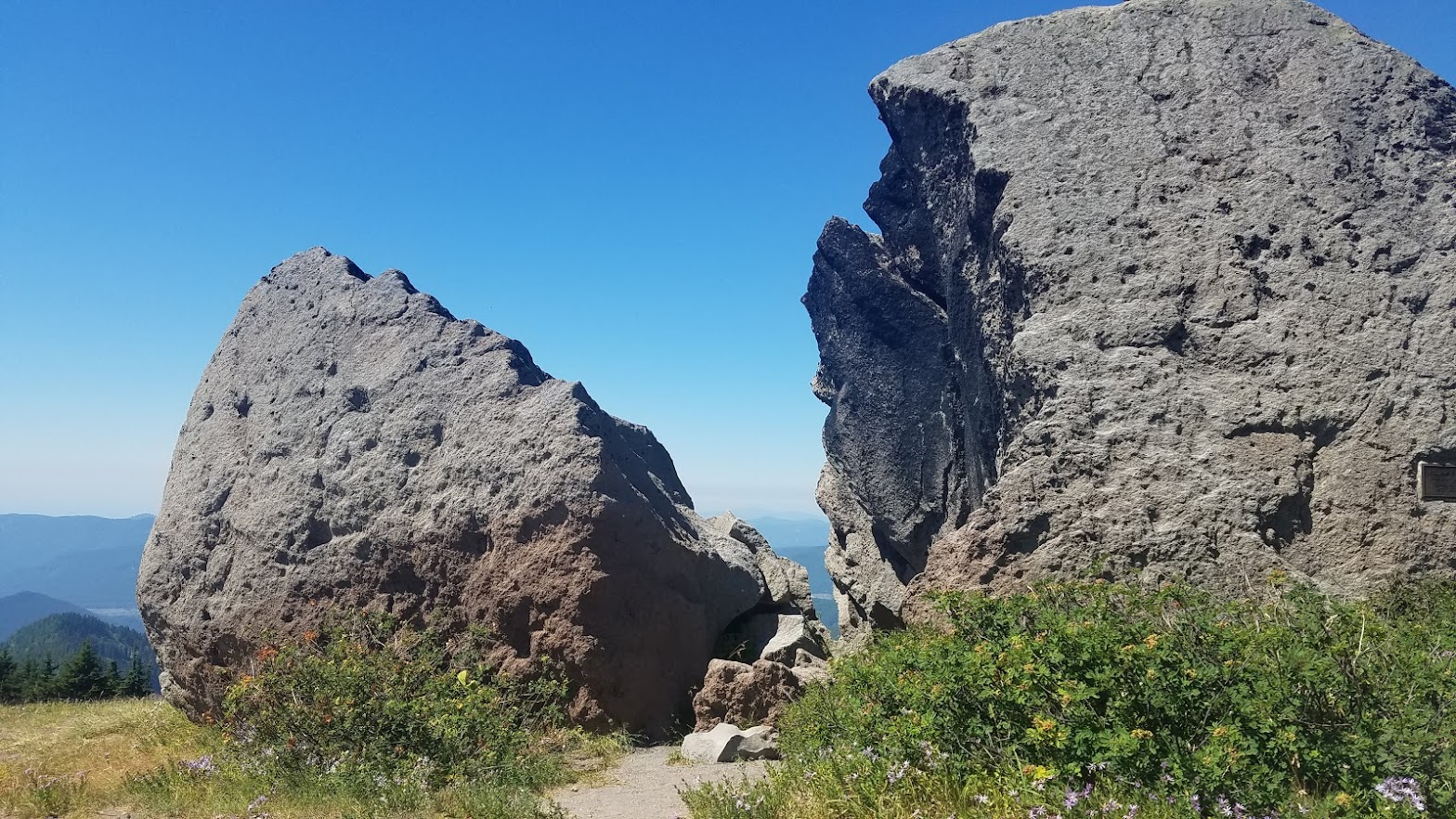
Carl had to climb to the top, of course. Plaques on the rock memorialized two people. We took another break in the shade of one lone tree, never wanting to leave the side of the mountain.

We continued our way back toward the PCT, taking our time with every step, and stopping for just one more photo. I really loved all the little creeks crisscrossing the landscape, and the wildflowers around every turn.

The trail eventually wound back to the PCT, and we said farewell to grand Mt. Hood.


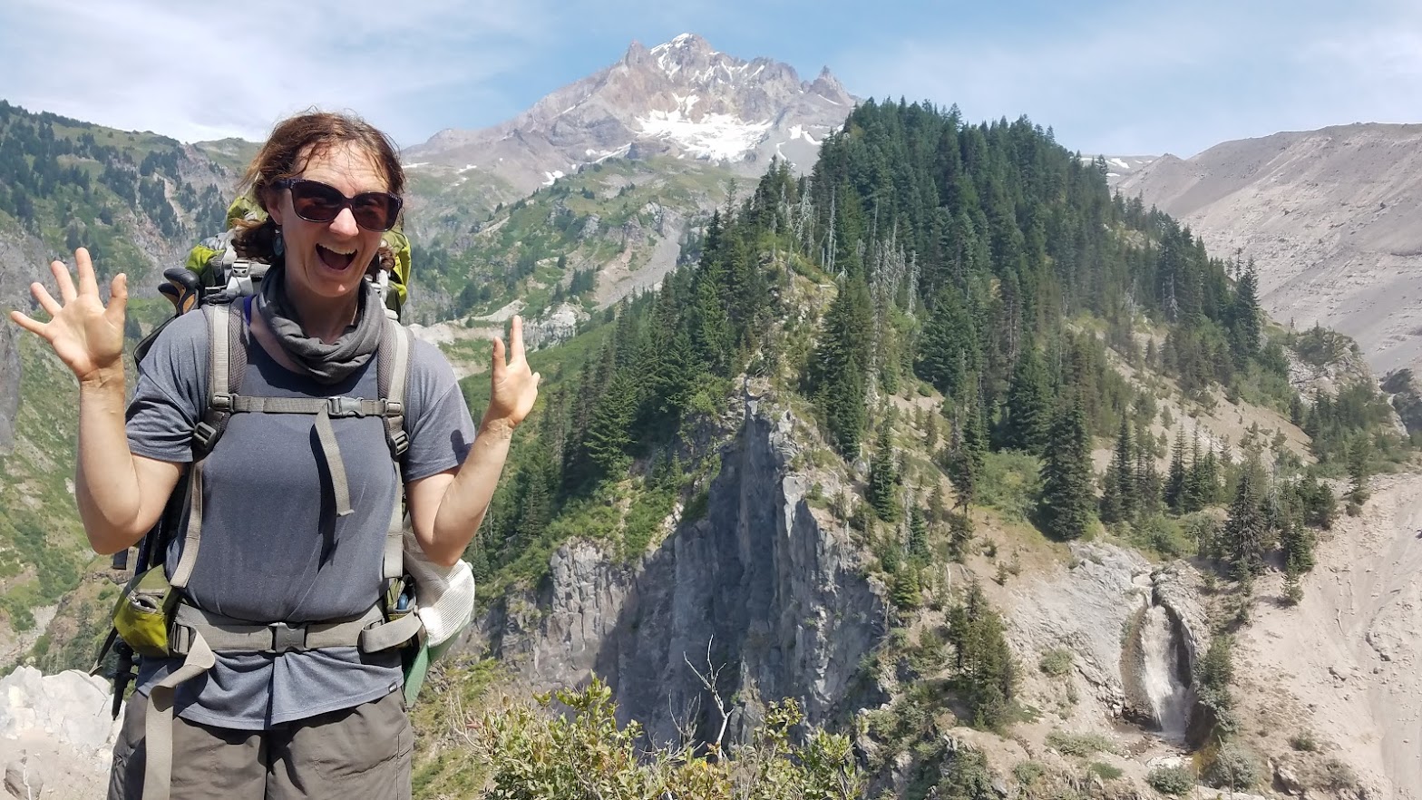
Two young women (we would see several more times in the coming days), offered to take a picture of us – and it’s one of my absolute favorites from my journey because it captures just how genuinely happy I was.
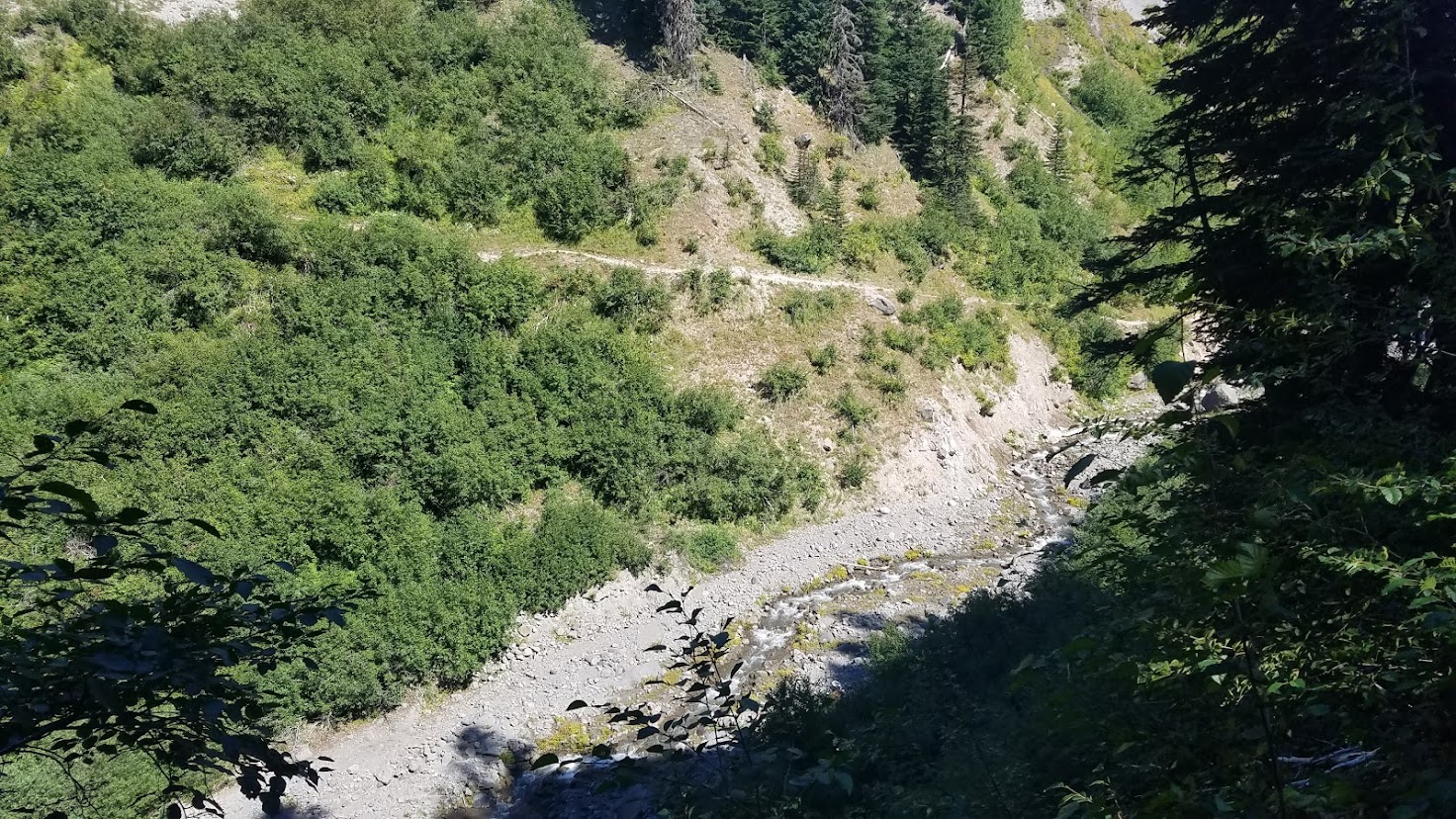
We were quickly approaching the Sandy River, and I knew this was probably going to be the trickiest crossing in Oregon. I was nervous. We stopped in a large camp not far from it, completely littered with trash. It was sad to see a place abused in such a manner. I picked up a few pieces of garbage to do my part, and hopefully some folks behind me did the same.
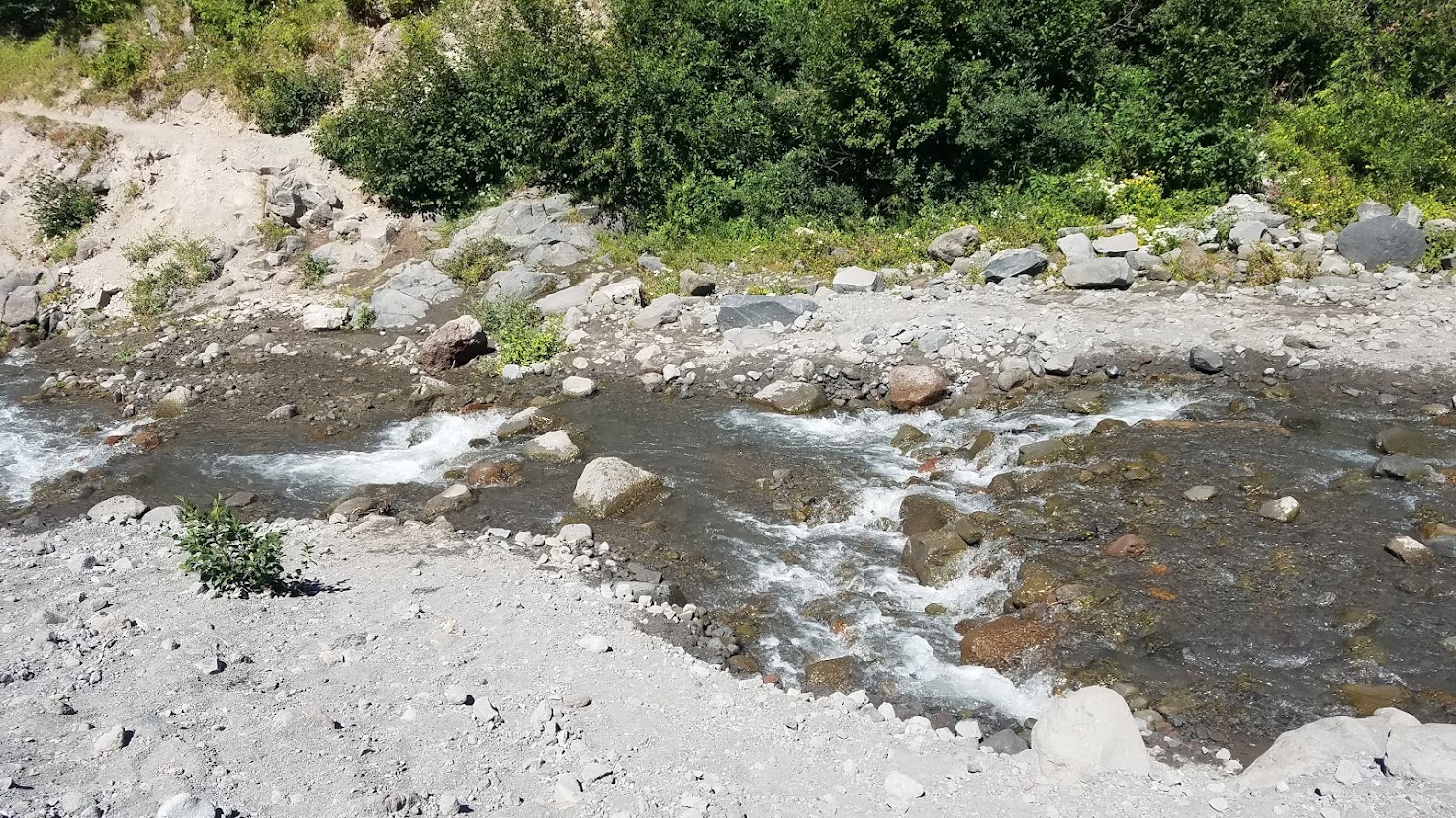
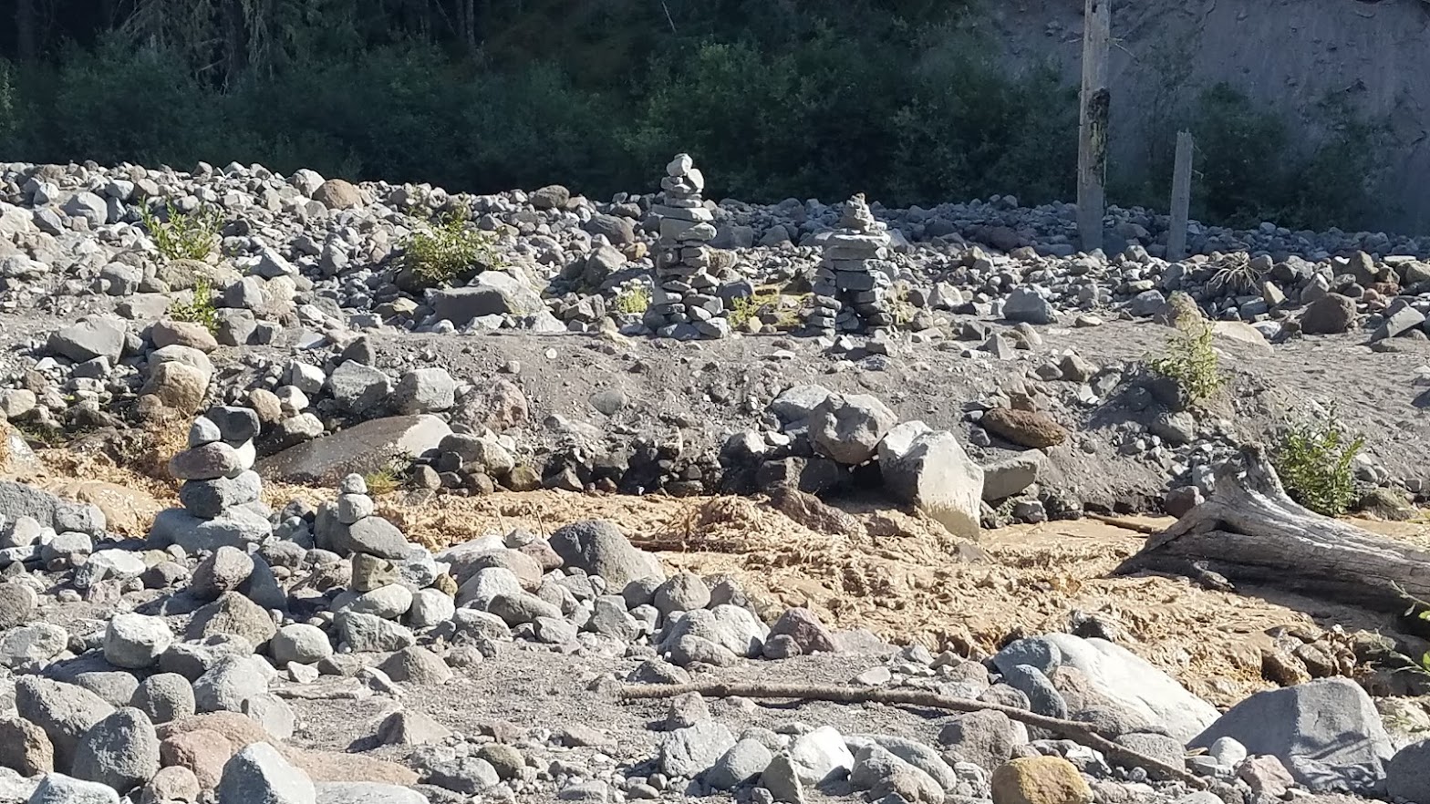
As we descended down, I saw a large creek, and thought that was our “dangerous” crossing, and was so excited thinking, “this will be easy.” However, hiking out onto an expansive rocky floodplain, I could hear water rushing. The Sandy was still in front of us.

My stomach dropped. The best time to cross rivers is in the morning before the snow melt, and it was now late in the day (4:30 p.m.). I assumed we would have to camp here for the night, because I wasn’t going to cross a rushing river. We popped over a hill, and spotted 8-10 people all in the process of crossing, and a man yells in our direction, “If you want help crossing; hurry, and do it now!”
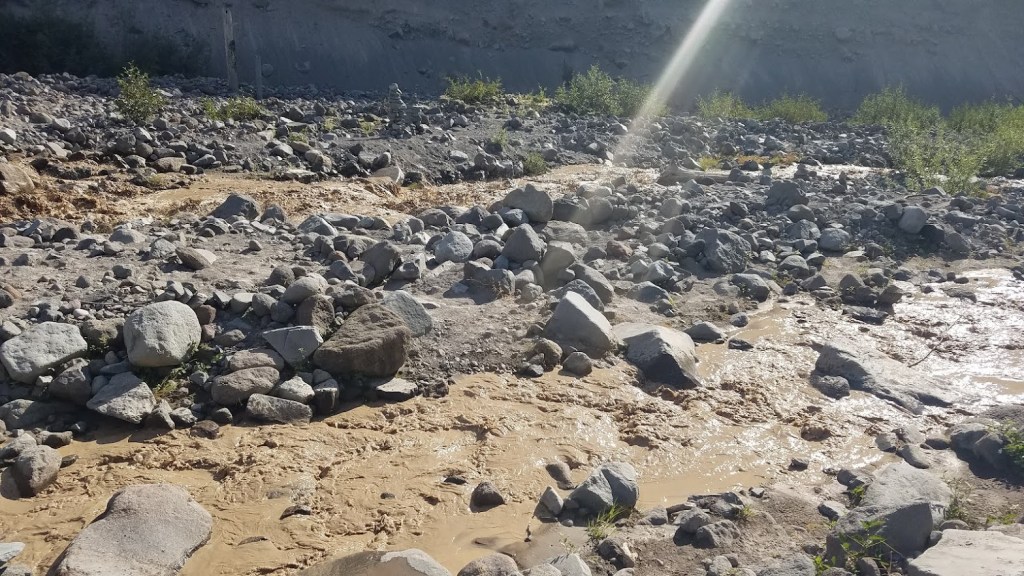
Talk about AMAZING Trail timing. Even though there were people in the water helping folks across, my first instinct was, “No way, we will camp overnight!” The water was dirty brown, and something about it rushing down the valley off the mountain seemed so menacing.
Carl wouldn’t let me chicken out though, plus we were gifted with the help of all these people, and I knew that shouldn’t be wasted. We quickly took off our boots and socks, and threw on our flip flops. As I watched a young woman just casually cross the river to come get my bag, I realized it must not be that bad.


I was SO thankful she grabbed my backpack for me. Apparently, she carried everyone’s pack across that was in the various groups, and she could tell I was nervous. We actually watched the water level fluctuate by 6-12 inches in the short time we were there crossing, it was pretty wild.
We crossed a small slippery log with the assistance of two men thigh-deep in the water, then rock hopped the remaining section. Carl went first, and made it without incident. I nearly lost a flip flop, but one of the men speared it with his trekking poles as the current took it downstream.
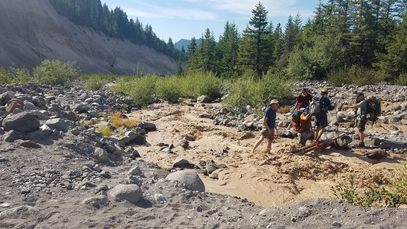
Safely across, I felt so energized and proud of myself. It really wasn’t bad, especially with the help of all the people. And it looks like nothing in the photos. (I promise it was a little more scary than what the photos depict.)

We still had a lot of miles to hike, so we were happy to be across the river. If we cut today short, the next two days would be especially difficult. Carl insists we would have been fine crossing the river if it was just the two of us, but I was happy to have our little crew’s assistance.
While we all got our boots and socks back on, we watched a man cross over all on his own. He wobbled for a moment, and we thought he might fall in, but he used his momentum to thrust himself across safely.
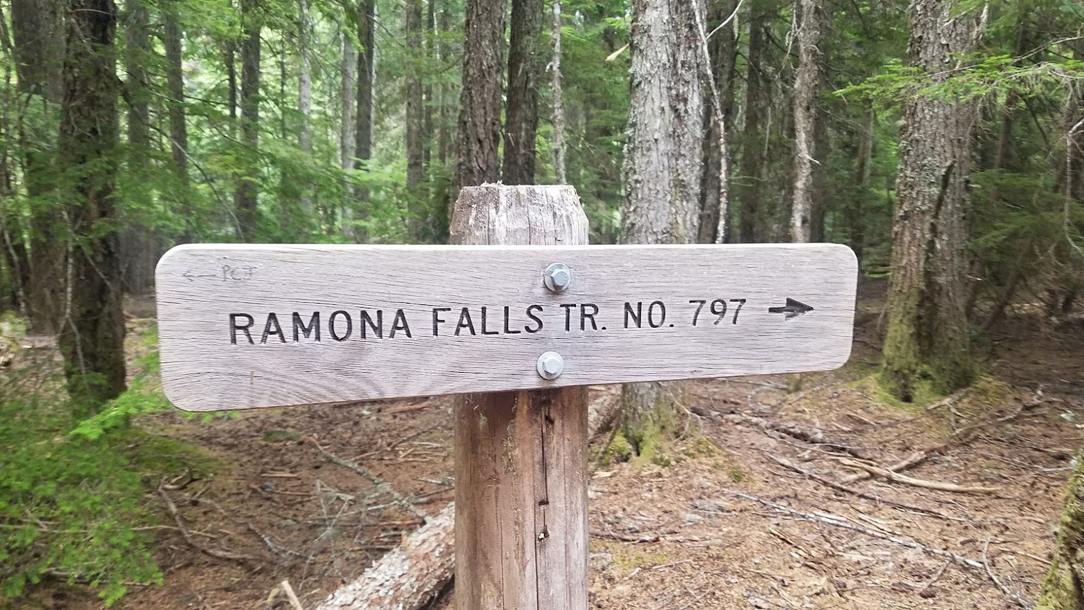
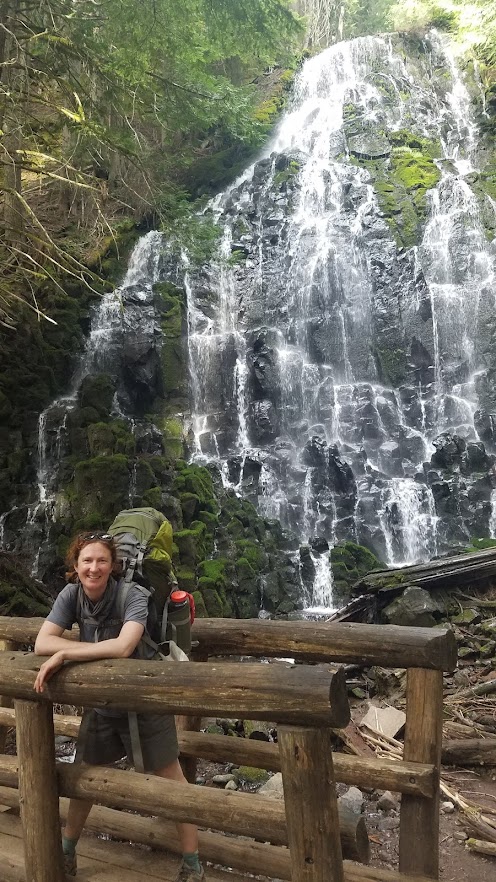
Hiking up out of the Sandy River Basin, we came to the Ramona Falls junction. This morning Carl and I discussed whether we should add the mileage, especially since the falls is a fairly accessible day hike from Portland, but we decided it was worth the .3 mile detour. That hike has been on my “to-do” hiking list for years, but the popularity always steers me to another option. (I don’t love crowds.) Plus, the river crossing crew was heading that way, so it felt like the thing to do.
Adding “waterfall” to our epic day was appropriate, and it’s a beauty! There were a lot of people at the falls, and mostly backpackers, which surprised me. I assumed we would see throngs of day hikers. Running low on water, we decided filtering from the falls would be fun, so we took a decent break to enjoy the view, and have a snack. Fortunately, the base around the falls was huge, so there was plenty of space for distancing.
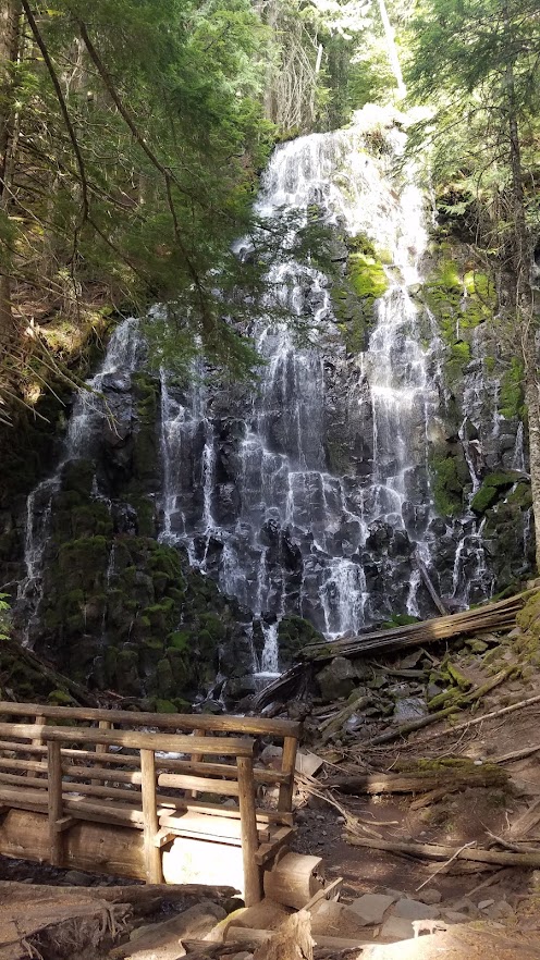

Everyone was filtering water from the falls. When Michelle and I experienced the Trail Magic near Olallie Lake, a fellow hiker warned me about a long stretch of waterless trail near Lolo Pass (our final destination for tonight). My book and PCT app told me otherwise, but the advice made me cautious, so we topped off just to be safe.
Leaving the falls at 5:45 p.m., with heavy watered down packs, we trucked it back to the PCT. It was a beautiful trail, and I would have loved to take my time, but we knew we were now racing the sun.
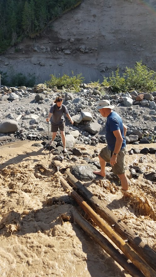
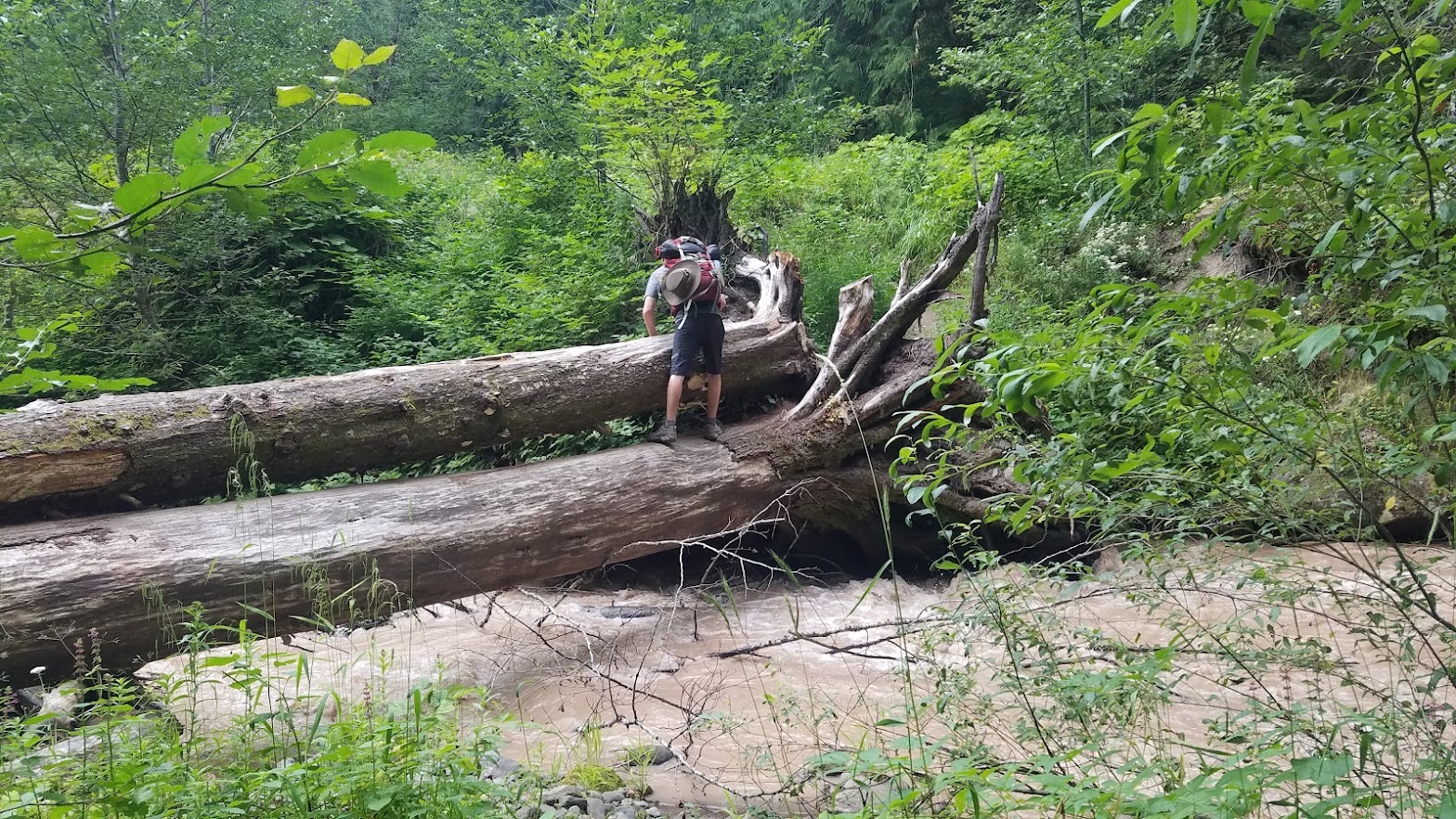
Muddy Fork Camp was the original destination for the night (before I realized I messed up my itinerary), and when we arrived, we were both ready to call it a day. Camping there would have been great, and we thought about it momentarily, but Carl was raring to go, and really wanted to push on. So, we faced our third, and final tricky water crossing for the day.

The trail crossed Muddy Fork River using two large downed trees. The bottom one is used to skirt your feet across, while the top one allows you to drape your body over to ensure you don’t fall, while the water rushes a few feet below.

I was stoked to have Carl. He cruised right over, and came back to take my pack across for me, similar to our first crossing. I think his height was a serious advantage. I took my time without a pack, and was still a little scared, especially since it was late in the day, and my body and mind were fatigued.
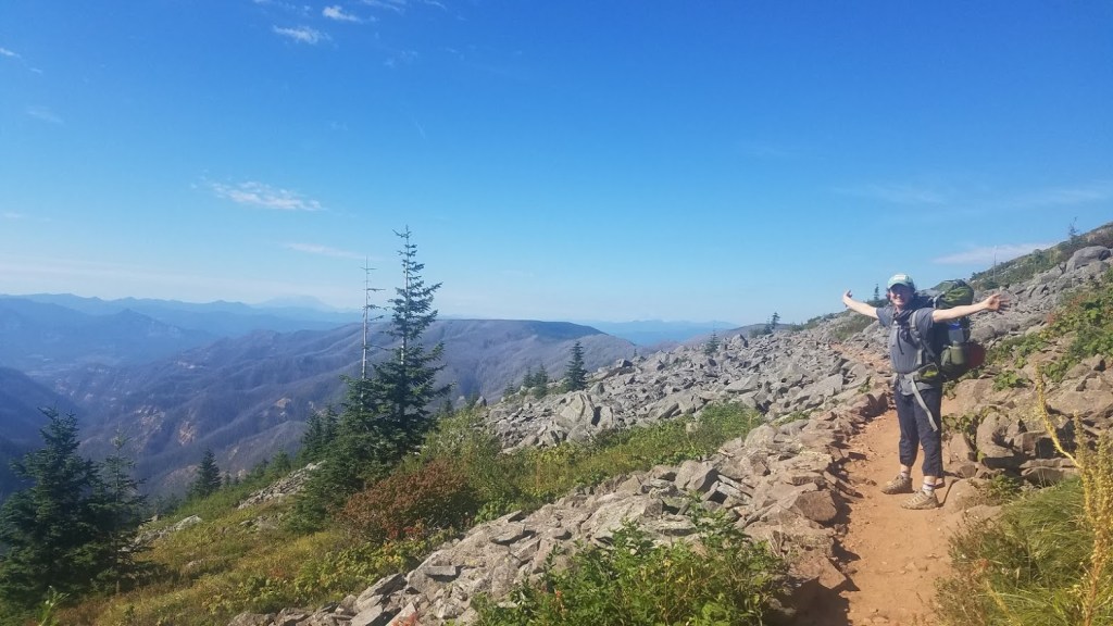
At 6:30 p.m., and facing 5.3 more miles to get to Lolo Pass, we started one of the toughest climbs in Oregon, (or maybe I was just exhausted from an already big day). The 2.5 miles up Bald Mountain kicked my butt, and I was moving slow. I wanted to hike quickly in our race with the sun, but my body just couldn’t do it.
I was slightly annoyed that Carl rocked it out so well. I’m the one that should have been in great shape after hiking nearly all of Oregon, but he cruised up that hill faster than me. Again, I think his long legs are an advantage. For me, it was one foot in front of the other.

We ran into the father / son pair who crossed the Sandy River with us, (saving my flip flop), and they were struggling too. The son was hiking all of Oregon as well, but started at Callahan’s Lodge for ease of trail access. His dad joined him at Olallie lake.
The sun was setting as we finally crested the Butte. We saw camping options at the top, but decided we should just get to Lolo Pass. Mt. Hood was now behind us, already looking so far away – how did that happen? Engulfed in that beautiful alpenglow, we stared for awhile, in awe of the majestic backdrop for our epic day, but light was fading quickly.

We found our headlamps so they would be at the ready when needed. Hiking across the ridge, I saw my first glimpse of Mt. Adams – the next mountain in the range. My heart sunk a little knowing I wouldn’t be hiking that far. Perhaps next year (2021) I would tackle some of Washington state, but for this year, Hood was my final volcano on my PCT Oregon adventure.
By the time we got to the edge of the ridge, we had to turn our headlamps on. This was my first PCT hike in the dark – it really was an epic day! Heading down those last two miles and descending
1000ft, I took the lead and booked it. Carl joked that he may have beat me on the uphill, but he had a hard time keeping up with me on the downhill. It was dark, and I was ready for camp!
We hiked for nearly 45 minutes in the dark. Luckily, we were in thick forest, so I don’t think we missed out on any grand views or anything, but I was really happy to not be hiking alone. Just a minute from camp, we passed a tent 6 inches off the trail in bushes with a very loud podcast playing from inside. It made us chuckle, but I assume the person felt safer a short distance from the designated camp.
It was 9:40 p.m. when we arrived at Lolo pass – we made it! I was nervous the camp would be full, but we got the entire place to ourselves. It was a not-so-scenic roadside trailhead camp, but it had a picnic table, and a big space for our tent; and suited our needs perfectly. One van was parked in the trailhead parking lot; we would see those folks the following morning.
After setting up the tent, we made the 2-person Pad Thai backpacker meal, which surprisingly was very different than the 1-person version, kinda odd, but equally good. We ate and fell asleep listening to the podcast down the trail. What a day!
Did you miss the beginning of my Oregon PCT journey? Begin with Day 1: Here


Please Leave a Reply!