-
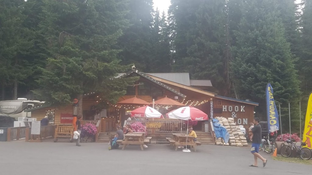
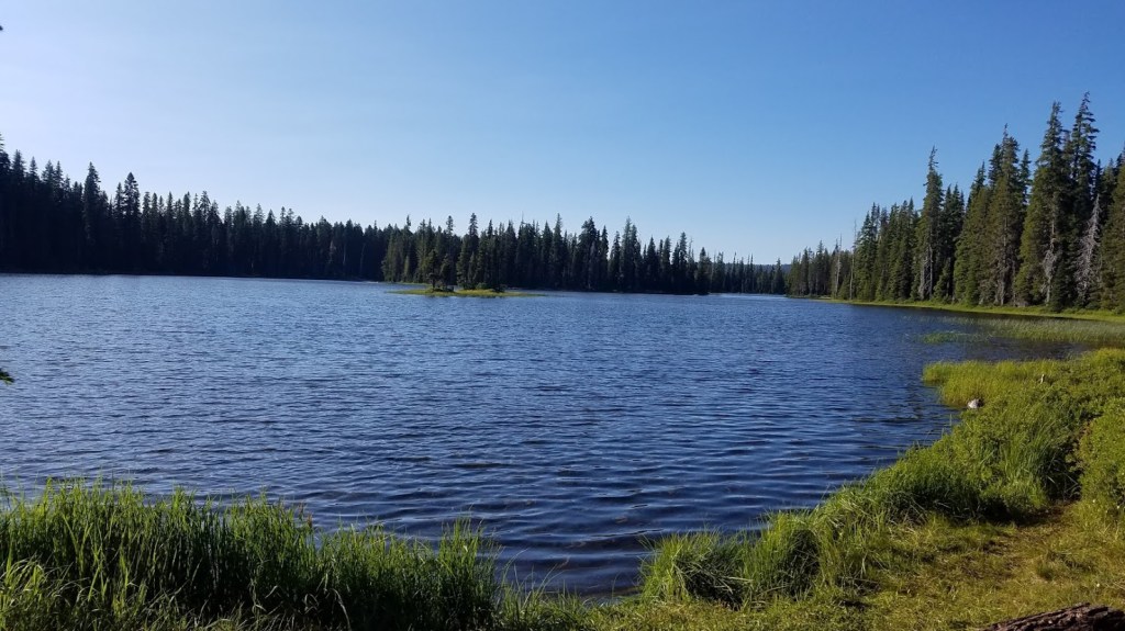
 Continue reading →: Pacific Crest Trail Day 18 – Zero Day at Odell Lake
Backpacking the Oregon Section of the Pacific Crest Trail enjoying a zero day at Odell Lake with the family.
-
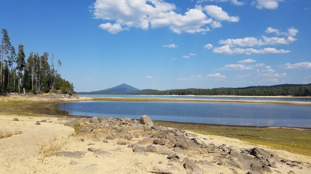
 Continue reading →: PCT Oregon – Day 17 to Odell Lake
Backpacking the Oregon Pacific Crest Trail – Day 17 to Odell Lake. Retelling my first day of getting lost with a happy ending reuniting with family.
-
 Continue reading →: Hiking the PCT Oregon – Day 16 to Crescent Lake
Hiking the Oregon section of the PCT – Day 16. Tolo Camp (near Windigo Pass) to Crescent Lake Horse Camp.
-
 Continue reading →: Pacific Crest Trail Oregon – Day 15 to Tolo Camp
Hiking the Oregon section of the Pacific Crest Trail, Day 15 to Tolo Camp near Windigo Pass.
-
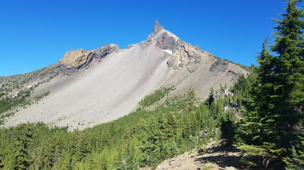 Continue reading →: PCT Oregon – Day 14 to Thielsen Creek
Hiking the Pacific Crest Trail (Oregon) day 14 from Grouse Hill backpacker camp in Crater Lake to Thielsen Creek – 17.3 miles.
-
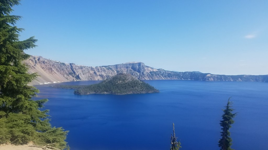
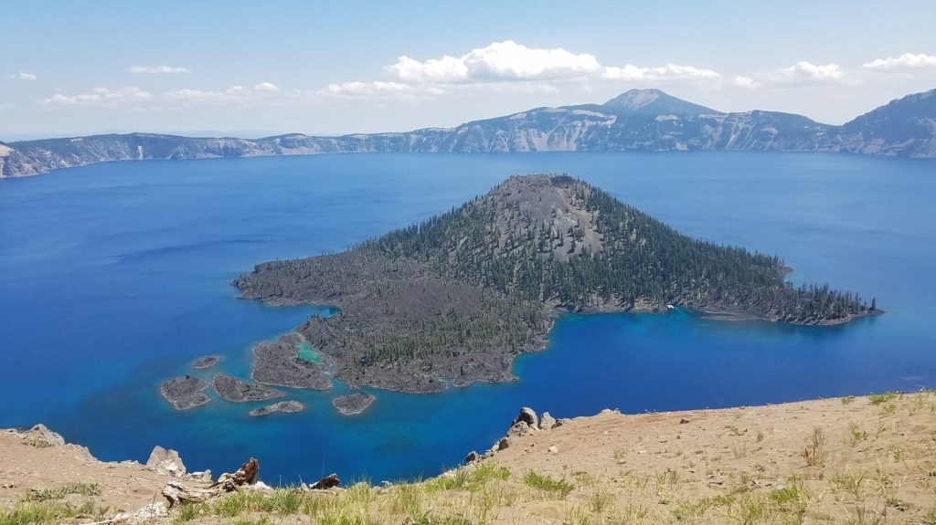 Continue reading →: Pacific Crest Trail Oregon – Day 13 to Grouse Hill Camp (Crater Lake)
Day 13 of my Oregon Pacific Trail journey takes me from Mazama Village along the Crater Lake Rim trail to Grouse Hill backpacker camp.
-
 Continue reading →: Oregon PCT Day 12 – Mazama Village to Crater Lake Rim
Day 12Today’s Miles: 5Total Miles: 139.2Mazama Village (Crater Lake Campground) to Crater Lake Rim My first “kinda” zero day. The plan was to hike along the rim tomorrow with my dad, and then reconnect with the PCT to continue north. I decided to hike the small section from the campground…
-
 Continue reading →: Hiking the Oregon PCT Day 11 to Mazama Village (Crater Lake): 22-Mile Day
Day 11Today’s Miles: 21.6Total Miles: 134.2Camp 10 (Seven Lakes Basin) to Mazama Village (Crater Lake Campground) I knew it was imperative to get an early start today. The plan was to hike nearly 22 miles – something I’ve never done before in my life, and I wanted to give myself…
-
 Continue reading →: PCT Oregon Day 10 to Seven Lakes Basin
Day 10Today’s Miles: 13.1Total Miles: 112.6Island Lake (Sky Lakes Wilderness) to Camp 10 (Seven Lakes Basin) I was awake at sunrise and ready to get out of Island Lake camp. Although I didn’t sleep well, I never let fear completely take over. I was a little scared off and on,…
-
 Continue reading →: Pacific Crest Trail Oregon: Day 9 to Island Lake
Day NineToday’s Miles: 15.6Total Miles: 99.5Fish Lake to Island Lake (Sky Lakes Wilderness) Despite feeling completely safe last night, I didn’t sleep well. I tossed and turned, waking up a dozen times. This became my new normal, and it wasn’t because I was uncomfortable. I had an amazing sleeping pad…
Hello,
I’m Heather
Welcome to my site where I share adventure stories, trail reports, and environmental insights. I’m a Pacific Northwest native, lived nearly my whole life in Oregon, and am currently residing in Portland, OR. With a background in marketing, event planning, and environmental conservation and a passion for all things outdoors, I enjoy writing about adventures. Take a deep dive into the Oregon Section of the Pacific Crest Trail with my daily trail reports from 2020. I love growing my circle – so connect with me on LinkedIn or Instagram!
Let’s connect
Join the fun!
Stay updated with my latest adventure reporting by joining the newsletter.